Home » Featured Articles » Geovisual Analytics applied to a Swedish Road Warning Prediction System
Geovisual Analytics applied to a Swedish Road Warning Prediction System
Lundblad P, Jern M: Geovisual Analytics applied to a Swedish Road Warning Prediction System, reviewed paper in proceedings, GI4DM Conference on Geo-Information Systems for Crisis Management – Harbin, China Aug 2008. (doc)
Summary
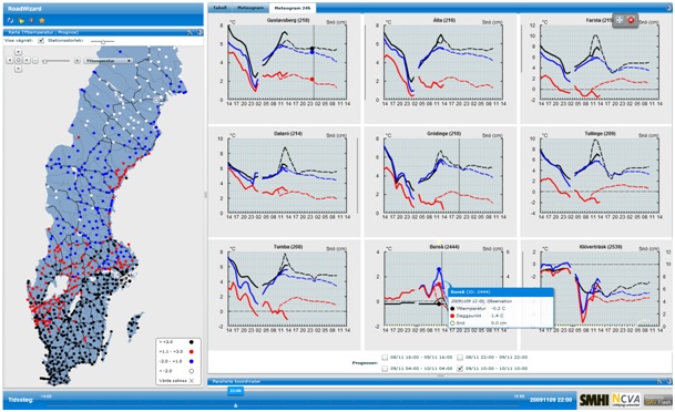
The Swedish road administration has for this winter season introduced an advanced road warning prediction system that has been developed in close collaboration with Swedish Meteorological and Hydrological Institute SMHI. This system gives the user an overview of the road situation depending on the weather situation. It gives the user a better overview and understanding of trends and situations that may arise. Large spatial-temporal and multivariate data are imported and updated in real time every 15 minutes.


0 Comments
You can be the first one to leave a comment.